Toggle navigation
Survey Documents
Advanced Search
Supporting Data
Companies
Surveyors
Communities
Original Townships
APIs
Survey Documents API
Tutorial
About
Contact
Search
0928 2 pages scanned, please download to view all scans
Download 0928.tif
GIS Data
Latitude:
41.0988599999999
Longitude:
-81.54665
Identification
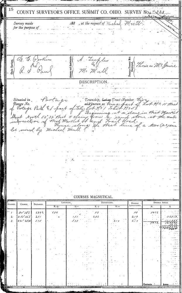
Survey identifier:
0928
Context
Original township:
Portage
Community list:
Akron
Surveyed on:
06/01/1889
Description
Owner:
Mull
Description:
Ely
Primary road:
W. Market St
Secondary road:
Portage Path
Near intersection:
Acreage:
Survey Locators
Tract list:
5
Lot list:
11 W.P.P.
Section list:
Quarter:
Surveyor
Surveyor number:
Surveyor name:
Company:
Summit County Surveyor
Document Data
Scan File Name:
0928.tif
Scan Pages:
2
Drawer location:
Survey Book 4 Pg 15