Toggle navigation
Survey Documents
Advanced Search
Supporting Data
Companies
Surveyors
Communities
Original Townships
APIs
Survey Documents API
Tutorial
About
Contact
Search
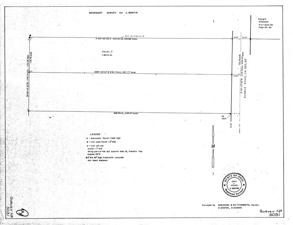
3031
Download lotsplits3031.tif
GIS Data
Latitude:
40.9716519999998
Longitude:
-81.638632
Identification
Survey identifier:
3031
Context
Original township:
Franklin
Community list:
Franklin
Surveyed on:
08/01/1973
Description
Owner:
Martin
Description:
Kungle Allotment Plat Book 50 Page 40 42
Primary road:
Kungle Rd
Secondary road:
Near intersection:
Grill Rd
Acreage:
1.9212
Survey Locators
Tract list:
Lot list:
Section list:
18
Quarter:
Surveyor
Surveyor number:
5746
Surveyor name:
Greissing, Gerald G.
Company:
Greissing & Butterworth
Document Data
Scan File Name:
lotsplits3031.tif
Scan Pages:
1
Drawer location: