Toggle navigation
Survey Documents
Advanced Search
Supporting Data
Companies
Surveyors
Communities
Original Townships
APIs
Survey Documents API
Tutorial
About
Contact
Search
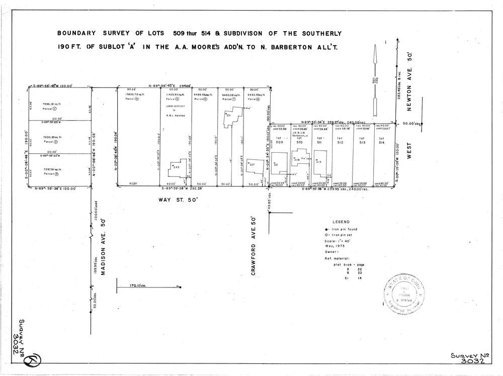
3032
Download lotsplits3032.tif
GIS Data
Latitude:
41.0285669999998
Longitude:
-81.598656
Identification
Survey identifier:
3032
Context
Original township:
Barberton
Community list:
Barberton
Surveyed on:
05/01/1973
Description
Owner:
Description:
Boundry Survey Of The Southerly 190 Ft Of Sublot A In The A.A. Moores Add'N To N. Barberton Allotment
Primary road:
Way St
Secondary road:
Near intersection:
Madison Ave
Acreage:
Survey Locators
Tract list:
Lot list:
Section list:
Quarter:
Surveyor
Surveyor number:
5746
Surveyor name:
Greissing, Gerald G.
Company:
Greissing & Butterworth
Document Data
Scan File Name:
lotsplits3032.tif
Scan Pages:
1
Drawer location: