Toggle navigation
Survey Documents
Advanced Search
Supporting Data
Companies
Surveyors
Communities
Original Townships
APIs
Survey Documents API
Tutorial
About
Contact
Search
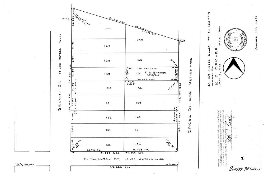
3260-1
Download lotsplits3260_1.tif
GIS Data
Latitude:
41.0662159999998
Longitude:
-81.509231
Identification
Survey identifier:
3260-1
Context
Original township:
Akron
Community list:
Akron
Surveyed on:
09/02/1973
Description
Owner:
Spicher
Description:
S/L 137 Ledge Allotment
Primary road:
Spicer St
Secondary road:
Near intersection:
Thornton St
Acreage:
Survey Locators
Tract list:
Lot list:
Section list:
Quarter:
Surveyor
Surveyor number:
4240
Surveyor name:
Fish, Robert J.
Company:
Document Data
Scan File Name:
lotsplits3260_1.tif
Scan Pages:
1
Drawer location: