Toggle navigation
Survey Documents
Advanced Search
Supporting Data
Companies
Surveyors
Communities
Original Townships
APIs
Survey Documents API
Tutorial
About
Contact
Search
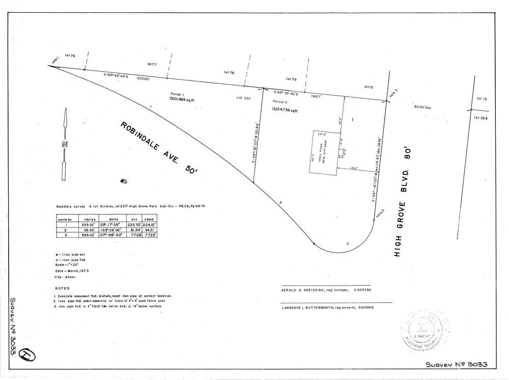
3033
Download lotsplits3033.tif
GIS Data
Latitude:
41.0550839999998
Longitude:
-81.429613
Identification
Survey identifier:
3033
Context
Original township:
Portage
Community list:
Akron
Surveyed on:
03/01/1973
Description
Owner:
Description:
Boundry Survey And Lot Division For High Grove Park
Primary road:
High Grove Blvd
Secondary road:
Near intersection:
Robindale Ave
Acreage:
Survey Locators
Tract list:
Lot list:
257
Section list:
Quarter:
Surveyor
Surveyor number:
5746
Surveyor name:
Greissing, Gerald G.
Company:
Greissing & Butterworth
Document Data
Scan File Name:
lotsplits3033.tif
Scan Pages:
1
Drawer location: