Toggle navigation
Survey Documents
Advanced Search
Supporting Data
Companies
Surveyors
Communities
Original Townships
APIs
Survey Documents API
Tutorial
About
Contact
Search
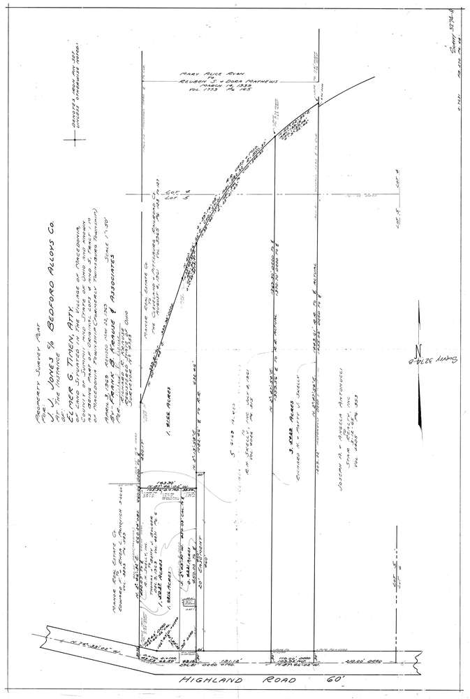
3274
Download lotsplits3274.tif
GIS Data
Latitude:
41.2981859999999
Longitude:
-81.482677
Identification
Survey identifier:
3274
Context
Original township:
Twinsburg
Community list:
Macedonia
Surveyed on:
05/22/1969
Description
Owner:
Jones
Description:
Primary road:
Highland Rd
Secondary road:
Near intersection:
Acreage:
9.5
Survey Locators
Tract list:
1
Lot list:
4, 5
Section list:
Quarter:
Surveyor
Surveyor number:
4753
Surveyor name:
Krause, Richard R.
Company:
Document Data
Scan File Name:
lotsplits3274.tif
Scan Pages:
1
Drawer location: