Toggle navigation
Survey Documents
Advanced Search
Supporting Data
Companies
Surveyors
Communities
Original Townships
APIs
Survey Documents API
Tutorial
About
Contact
Search
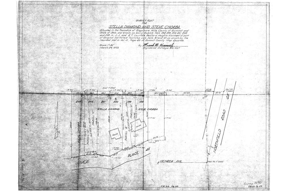
3276
Download Survey-3276.tif
GIS Data
Latitude:
41.3466559999999
Longitude:
-81.528913
Identification
Survey identifier:
3276
Context
Original township:
Northfield
Community list:
Sagamore Hills
Surveyed on:
03/24/1953
Description
Owner:
Diamond & Chorba
Description:
S/L 198, 199, 200, 201, 202 & 203 Lowries Bedford Heights Allotment
Primary road:
James Place
Secondary road:
Near intersection:
Acreage:
Survey Locators
Tract list:
Lot list:
31, 41
Section list:
Quarter:
Surveyor
Surveyor number:
567
Surveyor name:
Krause, Frank B.
Company:
Document Data
Scan File Name:
Survey-3276.tif
Scan Pages:
1
Drawer location: