Toggle navigation
Survey Documents
Advanced Search
Supporting Data
Companies
Surveyors
Communities
Original Townships
APIs
Survey Documents API
Tutorial
About
Contact
Search
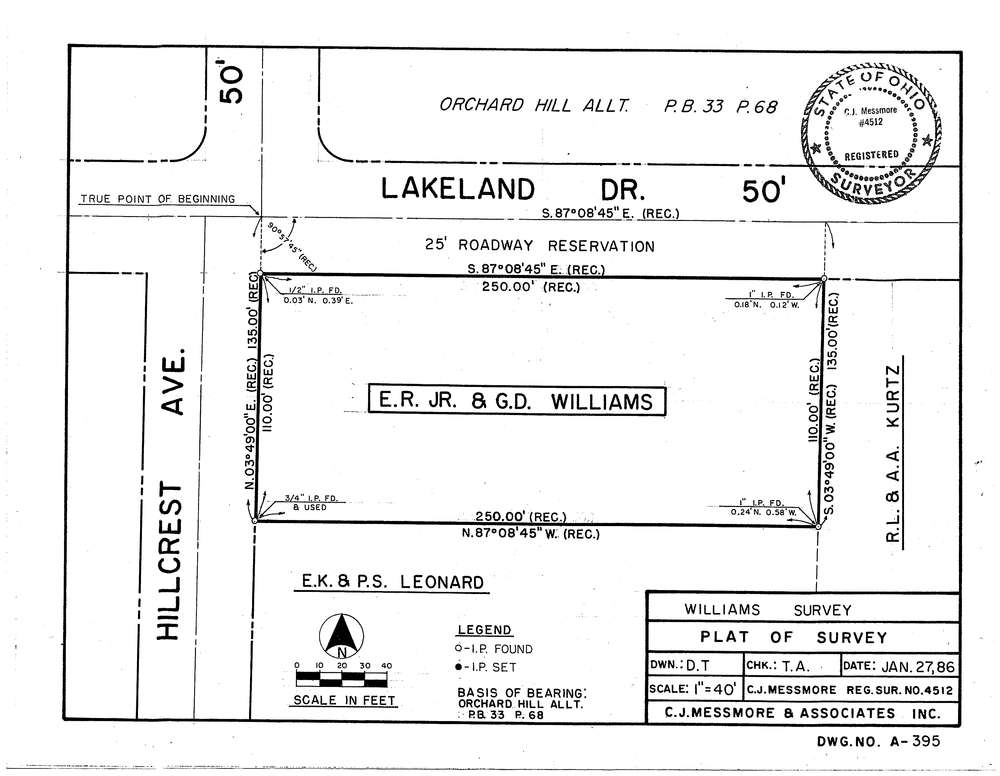
Mess-A395
Download A-395.tif
GIS Data
Latitude:
41.0470099999999
Longitude:
-81.64957
Identification
Survey identifier:
Mess-A395
Context
Original township:
Norton
Community list:
Norton
Surveyed on:
01/27/1986
Description
Owner:
Williams
Description:
Orchard Hill Allt. PB33 P68
Primary road:
Lakeland Dr
Secondary road:
Hillcrest Ave
Near intersection:
Acreage:
Survey Locators
Tract list:
Lot list:
Section list:
Quarter:
Surveyor
Surveyor number:
4512
Surveyor name:
Messmore, Charles J.
Company:
C.J. Messmore & Associates
Document Data
Scan File Name:
A-395.tif
Scan Pages:
1
Drawer location:
261