Toggle navigation
Survey Documents
Advanced Search
Supporting Data
Companies
Surveyors
Communities
Original Townships
APIs
Survey Documents API
Tutorial
About
Contact
Search
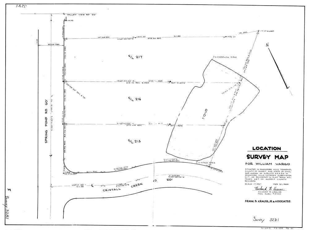
3281
Download lotsplits3281.tif
GIS Data
Latitude:
41.3278739999999
Longitude:
-81.548381
Identification
Survey identifier:
3281
Context
Original township:
Northfield
Community list:
Sagamore Hills
Surveyed on:
02/21/1963
Description
Owner:
Vargo
Description:
S/L 215 & 216 Sagamore Hills Estates Subdivision #7
Primary road:
Spring Pond Rd
Secondary road:
Near intersection:
Crystal Creek Rd
Acreage:
Survey Locators
Tract list:
Lot list:
Section list:
Quarter:
Surveyor
Surveyor number:
4753
Surveyor name:
Krause, Richard R.
Company:
Document Data
Scan File Name:
lotsplits3281.tif
Scan Pages:
1
Drawer location: