Toggle navigation
Survey Documents
Advanced Search
Supporting Data
Companies
Surveyors
Communities
Original Townships
APIs
Survey Documents API
Tutorial
About
Contact
Search
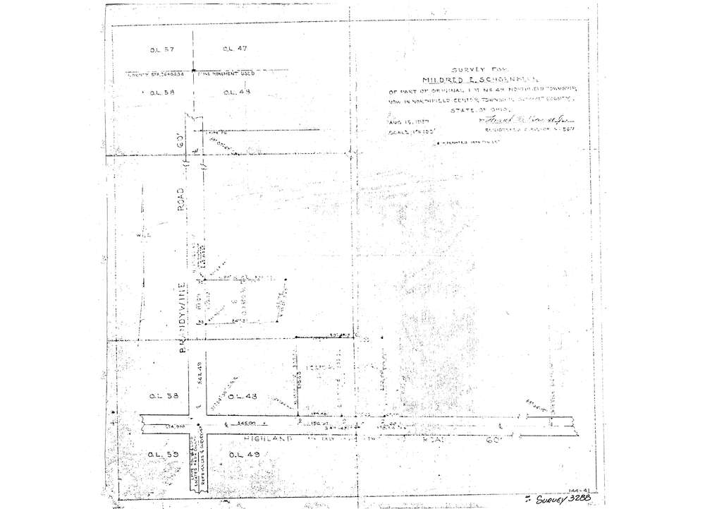
3288
Download lotsplits3288.tif
GIS Data
Latitude:
41.2931889999998
Longitude:
-81.538339
Identification
Survey identifier:
3288
Context
Original township:
Northfield
Community list:
Northfield
Surveyed on:
08/15/1957
Description
Owner:
Schoenbeck
Description:
Primary road:
Highland Rd
Secondary road:
Near intersection:
Brandywine Rd
Acreage:
1.033
Survey Locators
Tract list:
Lot list:
48
Section list:
Quarter:
Surveyor
Surveyor number:
567
Surveyor name:
Krause, Frank B.
Company:
Document Data
Scan File Name:
lotsplits3288.tif
Scan Pages:
1
Drawer location: