Toggle navigation
Survey Documents
Advanced Search
Supporting Data
Companies
Surveyors
Communities
Original Townships
APIs
Survey Documents API
Tutorial
About
Contact
Search
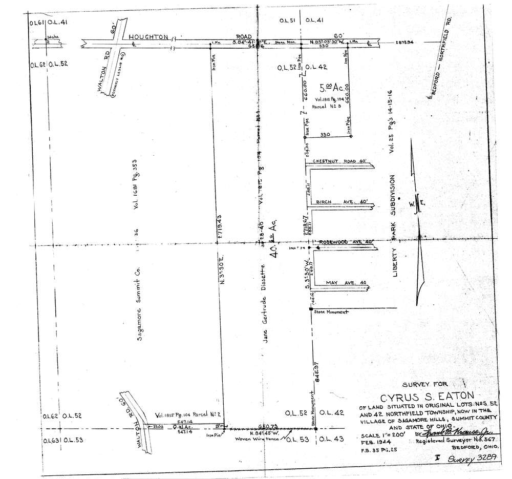
3289
Download lotsplits3289.tif
GIS Data
Latitude:
41.3423419999999
Longitude:
-81.540484
Identification
Survey identifier:
3289
Context
Original township:
Northfield
Community list:
Sagamore Hills
Surveyed on:
02/01/1944
Description
Owner:
Eaton
Description:
Primary road:
Houghton Rd
Secondary road:
Near intersection:
Walton Rd
Acreage:
45.0
Survey Locators
Tract list:
Lot list:
42, 52
Section list:
Quarter:
Surveyor
Surveyor number:
567
Surveyor name:
Krause, Frank B.
Company:
Document Data
Scan File Name:
lotsplits3289.tif
Scan Pages:
1
Drawer location: