Toggle navigation
Survey Documents
Advanced Search
Supporting Data
Companies
Surveyors
Communities
Original Townships
APIs
Survey Documents API
Tutorial
About
Contact
Search
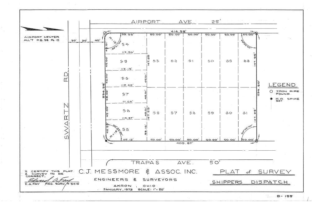
Mess-B155
Download B-155.tif
GIS Data
Latitude:
41.0181899999999
Longitude:
-81.49348
Identification
Survey identifier:
Mess-B155
Context
Original township:
Coventry
Community list:
Akron
Surveyed on:
01/01/1973
Description
Owner:
Description:
Airport Center All't PB38 PG15
Primary road:
Swartz Rd
Secondary road:
Airport Ave
Near intersection:
Trapas Ave
Acreage:
Survey Locators
Tract list:
Lot list:
Section list:
Quarter:
Surveyor
Surveyor number:
5415
Surveyor name:
Fay, Edward A.
Company:
C.J. Messmore & Associates
Document Data
Scan File Name:
B-155.tif
Scan Pages:
1
Drawer location:
261