Toggle navigation
Survey Documents
Advanced Search
Supporting Data
Companies
Surveyors
Communities
Original Townships
APIs
Survey Documents API
Tutorial
About
Contact
Search
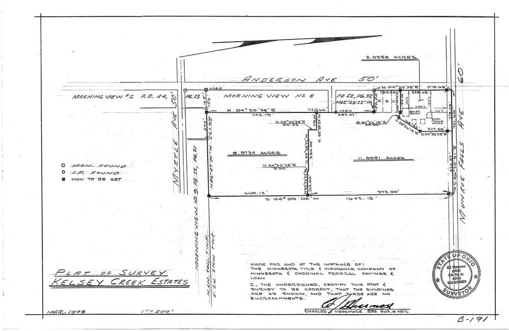
Mess-B191
Download B-191.tif
GIS Data
Latitude:
41.1400499999999
Longitude:
-81.45988
Identification
Survey identifier:
Mess-B191
Context
Original township:
Stow
Community list:
Munroe Falls
Surveyed on:
03/01/1978
Description
Owner:
Description:
Kelsey Creek Estates
Primary road:
Munroe Falls Ave
Secondary road:
Anderson Ave
Near intersection:
Acreage:
Survey Locators
Tract list:
Lot list:
Section list:
Quarter:
Surveyor
Surveyor number:
4512
Surveyor name:
Messmore, Charles J.
Company:
C.J. Messmore & Associates
Document Data
Scan File Name:
B-191.tif
Scan Pages:
1
Drawer location:
261