Toggle navigation
Survey Documents
Advanced Search
Supporting Data
Companies
Surveyors
Communities
Original Townships
APIs
Survey Documents API
Tutorial
About
Contact
Search
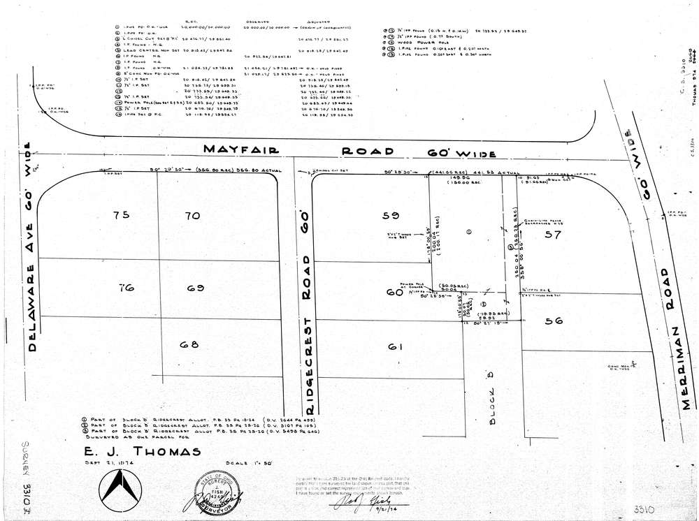
3310
Download lotsplits3310.tif
GIS Data
Latitude:
41.1180779999998
Longitude:
-81.54322
Identification
Survey identifier:
3310
Context
Original township:
Akron
Community list:
Akron
Surveyed on:
09/21/1974
Description
Owner:
Thomas
Description:
Part Of Block B Ridgecrest Allot
Primary road:
Mayfair Rd
Secondary road:
Merriman Rd
Near intersection:
Ridgecrest Rd
Acreage:
Survey Locators
Tract list:
Lot list:
Section list:
Quarter:
Surveyor
Surveyor number:
4240
Surveyor name:
Fish, Robert J.
Company:
Document Data
Scan File Name:
lotsplits3310.tif
Scan Pages:
1
Drawer location: