Toggle navigation
Survey Documents
Advanced Search
Supporting Data
Companies
Surveyors
Communities
Original Townships
APIs
Survey Documents API
Tutorial
About
Contact
Search
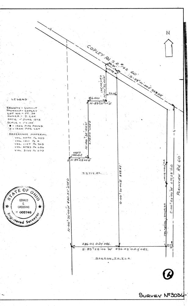
3036-2
Download lotsplits3036_2.tif
GIS Data
Latitude:
41.0907289999998
Longitude:
-81.614444
Identification
Survey identifier:
3036-2
Context
Original township:
Copley
Community list:
Copley
Surveyed on:
06/01/1973
Description
Owner:
Cox
Description:
Primary road:
Copley Rd
Secondary road:
Near intersection:
Plainview Rd
Acreage:
Survey Locators
Tract list:
Lot list:
34
Section list:
Quarter:
Surveyor
Surveyor number:
5746
Surveyor name:
Greissing, Gerald G.
Company:
Document Data
Scan File Name:
lotsplits3036_2.tif
Scan Pages:
1
Drawer location: