Toggle navigation
Survey Documents
Advanced Search
Supporting Data
Companies
Surveyors
Communities
Original Townships
APIs
Survey Documents API
Tutorial
About
Contact
Search
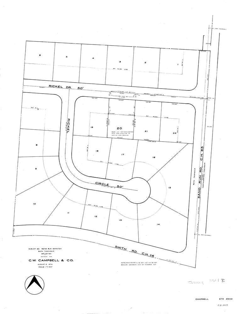
3317
Download lotsplits3317.tif
GIS Data
Latitude:
41.1419339999999
Longitude:
-81.588571
Identification
Survey identifier:
3317
Context
Original township:
Bath
Community list:
Akron
Surveyed on:
08/02/1974
Description
Owner:
Campbell
Description:
Lot 20 Sand Run Est
Primary road:
Rickel Dr
Secondary road:
Smith Rd
Near intersection:
Sand Run Rd
Acreage:
Survey Locators
Tract list:
Lot list:
Section list:
Quarter:
Surveyor
Surveyor number:
4240
Surveyor name:
Fish, Robert J.
Company:
Document Data
Scan File Name:
lotsplits3317.tif
Scan Pages:
1
Drawer location: