Toggle navigation
Survey Documents
Advanced Search
Supporting Data
Companies
Surveyors
Communities
Original Townships
APIs
Survey Documents API
Tutorial
About
Contact
Search
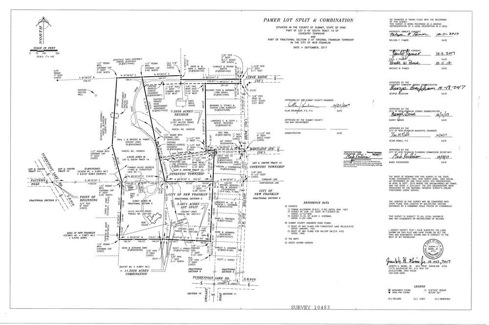
10483
Download Survey-10483.tif
GIS Data
Latitude:
40.9874699999999
Longitude:
-81.57064
Identification
Survey identifier:
10483
Context
Original township:
Community list:
Coventry,Franklin
Surveyed on:
10/24/2017
Description
Owner:
Pamer
Description:
Survey Lot Consolidation and Split
Primary road:
Hilltop Drive
Secondary road:
Turkeyfoot Lake Road
Near intersection:
Maryland Ave
Acreage:
18.7686
Survey Locators
Tract list:
14
Lot list:
5
Section list:
3
Quarter:
fractional
Surveyor
Surveyor number:
6732
Surveyor name:
Moine, Joseph H. Jr.
Company:
Joseph H. Moine Jr. Ps
Document Data
Scan File Name:
Survey-10483.tif
Scan Pages:
1
Drawer location:
003