Toggle navigation
Survey Documents
Advanced Search
Supporting Data
Companies
Surveyors
Communities
Original Townships
APIs
Survey Documents API
Tutorial
About
Contact
Search
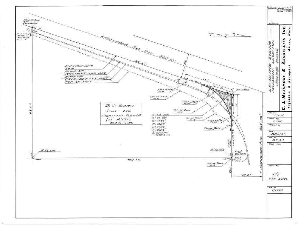
Mess-C726
Download C-726.tif
GIS Data
Latitude:
41.0231299999999
Longitude:
-81.43254
Identification
Survey identifier:
Mess-C726
Context
Original township:
Springfield
Community list:
Lakemore
Surveyed on:
10/18/1987
Description
Owner:
Smith
Description:
Highland Grove 1st Add'n PB11 PG25
Primary road:
Catherine Ave
Secondary road:
Near intersection:
Acreage:
Survey Locators
Tract list:
Lot list:
Section list:
Quarter:
Surveyor
Surveyor number:
4512
Surveyor name:
Messmore, Charles J.
Company:
C.J. Messmore & Associates
Document Data
Scan File Name:
C-726.tif
Scan Pages:
1
Drawer location:
263