Toggle navigation
Survey Documents
Advanced Search
Supporting Data
Companies
Surveyors
Communities
Original Townships
APIs
Survey Documents API
Tutorial
About
Contact
Search
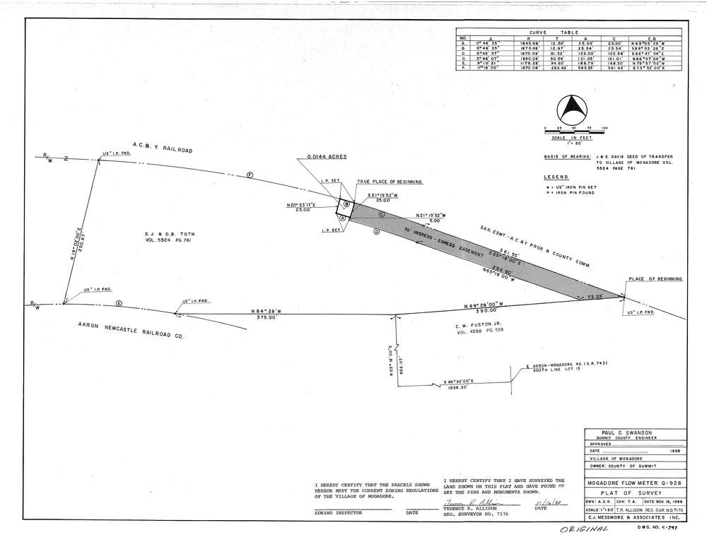
Mess-C797
Download C-797.tif
GIS Data
Latitude:
41.0517899999999
Longitude:
-81.39366
Identification
Survey identifier:
Mess-C797
Context
Original township:
Springfield
Community list:
Mogadore
Surveyed on:
11/16/1988
Description
Owner:
County of Summit
Description:
Mogadore Flow Meter Q-928
Primary road:
Mogadore Rd
Secondary road:
Near intersection:
Acreage:
Survey Locators
Tract list:
Lot list:
13
Section list:
Quarter:
Surveyor
Surveyor number:
7176
Surveyor name:
Allison, Terence R.
Company:
C.J. Messmore & Associates
Document Data
Scan File Name:
C-797.tif
Scan Pages:
1
Drawer location:
263