Toggle navigation
Survey Documents
Advanced Search
Supporting Data
Companies
Surveyors
Communities
Original Townships
APIs
Survey Documents API
Tutorial
About
Contact
Search
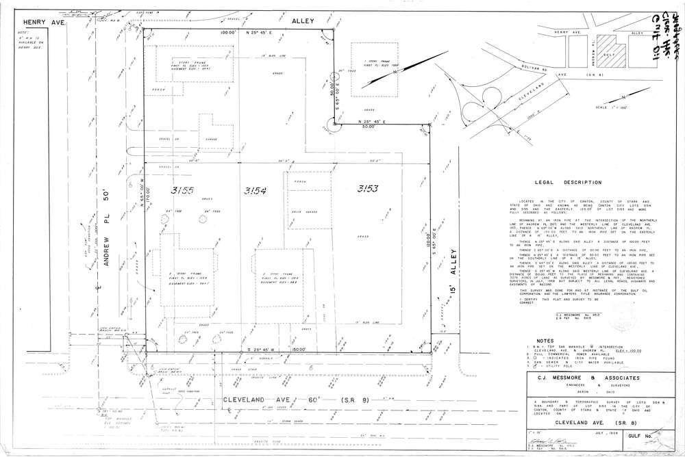
Mess-D152
Download D-152.tif
GIS Data
Latitude:
40.7888599999999
Longitude:
-81.38068
Identification
Survey identifier:
Mess-D152
Context
Original township:
Stark County
Community list:
Canton
Surveyed on:
07/01/1968
Description
Owner:
Gulf Oil Corp.
Description:
Primary road:
Cleveland Ave
Secondary road:
Andrew Pl
Near intersection:
Henry Ave
Acreage:
Survey Locators
Tract list:
Lot list:
Section list:
Quarter:
Surveyor
Surveyor number:
4512
Surveyor name:
Messmore, Charles J.
Company:
C.J. Messmore & Associates
Document Data
Scan File Name:
D-152.tif
Scan Pages:
1
Drawer location:
264