Toggle navigation
Survey Documents
Advanced Search
Supporting Data
Companies
Surveyors
Communities
Original Townships
APIs
Survey Documents API
Tutorial
About
Contact
Search
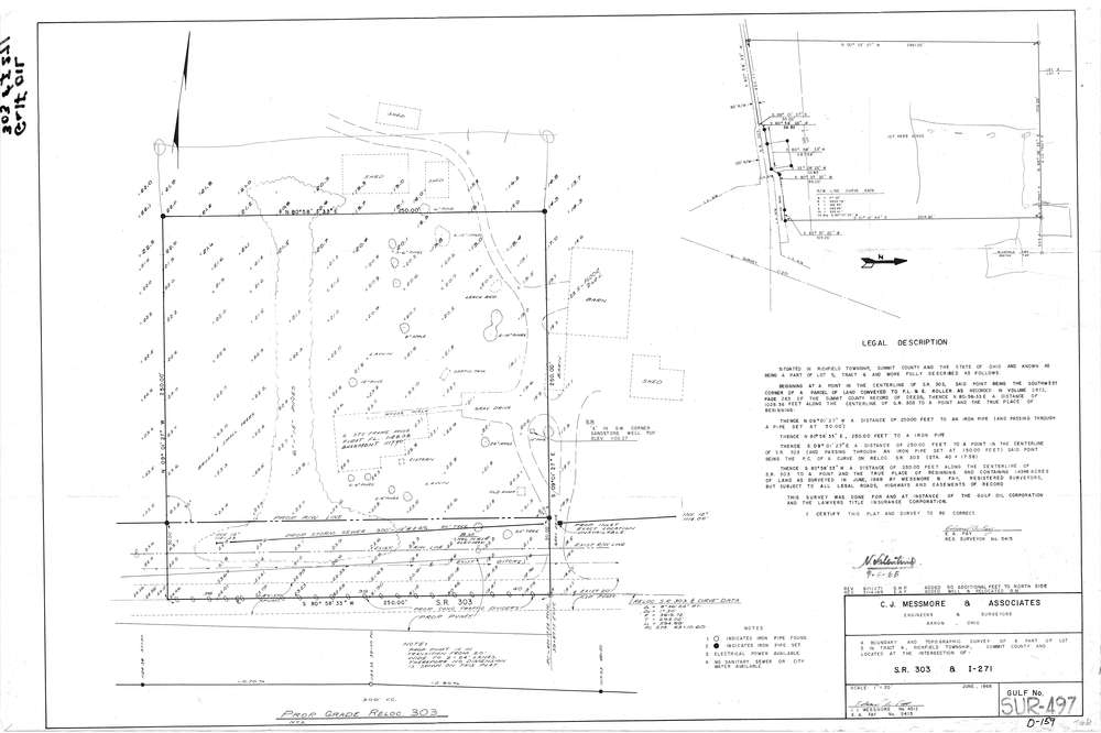
Mess-D159
Download D-159.tif
GIS Data
Latitude:
41.2470399999998
Longitude:
-81.59935
Identification
Survey identifier:
Mess-D159
Context
Original township:
Richfield
Community list:
Richfield
Surveyed on:
06/01/1968
Description
Owner:
Description:
Primary road:
SR 303
Secondary road:
Near intersection:
I 271
Acreage:
Survey Locators
Tract list:
6
Lot list:
5
Section list:
Quarter:
Surveyor
Surveyor number:
5415
Surveyor name:
Fay, Edward A.
Company:
C.J. Messmore & Associates
Document Data
Scan File Name:
D-159.tif
Scan Pages:
1
Drawer location:
264