Toggle navigation
Survey Documents
Advanced Search
Supporting Data
Companies
Surveyors
Communities
Original Townships
APIs
Survey Documents API
Tutorial
About
Contact
Search
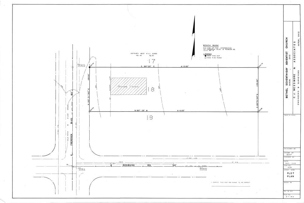
Mess-D183
Download D-183.tif
GIS Data
Latitude:
41.0695599999998
Longitude:
-81.57246
Identification
Survey identifier:
Mess-D183
Context
Original township:
Portage
Community list:
Akron
Surveyed on:
05/01/1969
Description
Owner:
Bethel Seventh Day Adventist Church
Description:
Arthur's West Hill Acres PB40 PG32
Primary road:
Redbush Rd
Secondary road:
Frederick Blvd
Near intersection:
Acreage:
Survey Locators
Tract list:
Lot list:
Section list:
Quarter:
Surveyor
Surveyor number:
4512
Surveyor name:
Messmore, Charles J.
Company:
C.J. Messmore & Associates
Document Data
Scan File Name:
D-183.tif
Scan Pages:
1
Drawer location:
264