Toggle navigation
Survey Documents
Advanced Search
Supporting Data
Companies
Surveyors
Communities
Original Townships
APIs
Survey Documents API
Tutorial
About
Contact
Search
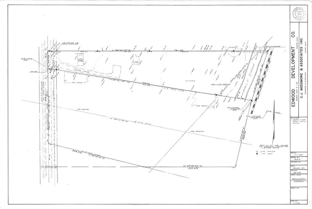
Mess-D209
Download D-209.tif
GIS Data
Latitude:
41.0406899999998
Longitude:
-81.60713
Identification
Survey identifier:
Mess-D209
Context
Original township:
Norton
Community list:
Norton
Surveyed on:
02/01/1970
Description
Owner:
Edwood Development Co.
Description:
Primary road:
Barber Rd
Secondary road:
Near intersection:
Acreage:
1.9769
Survey Locators
Tract list:
Lot list:
29
Section list:
Quarter:
Surveyor
Surveyor number:
4512
Surveyor name:
Messmore, Charles J.
Company:
C.J. Messmore & Associates
Document Data
Scan File Name:
D-209.tif
Scan Pages:
1
Drawer location:
264