Toggle navigation
Survey Documents
Advanced Search
Supporting Data
Companies
Surveyors
Communities
Original Townships
APIs
Survey Documents API
Tutorial
About
Contact
Search
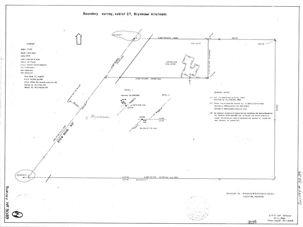
3039
Download lotsplits3039.tif
GIS Data
Latitude:
41.1760859999998
Longitude:
-81.432434
Identification
Survey identifier:
3039
Context
Original township:
Stow
Community list:
Stow
Surveyed on:
06/01/1973
Description
Owner:
Hahn
Description:
Brynmawr Allotment
Primary road:
Stow Rd
Secondary road:
Near intersection:
Acreage:
Survey Locators
Tract list:
Lot list:
56
Section list:
Quarter:
Surveyor
Surveyor number:
5746
Surveyor name:
Greissing, Gerald G.
Company:
Greissing & Butterworth
Document Data
Scan File Name:
lotsplits3039.tif
Scan Pages:
1
Drawer location: