Toggle navigation
Survey Documents
Advanced Search
Supporting Data
Companies
Surveyors
Communities
Original Townships
APIs
Survey Documents API
Tutorial
About
Contact
Search
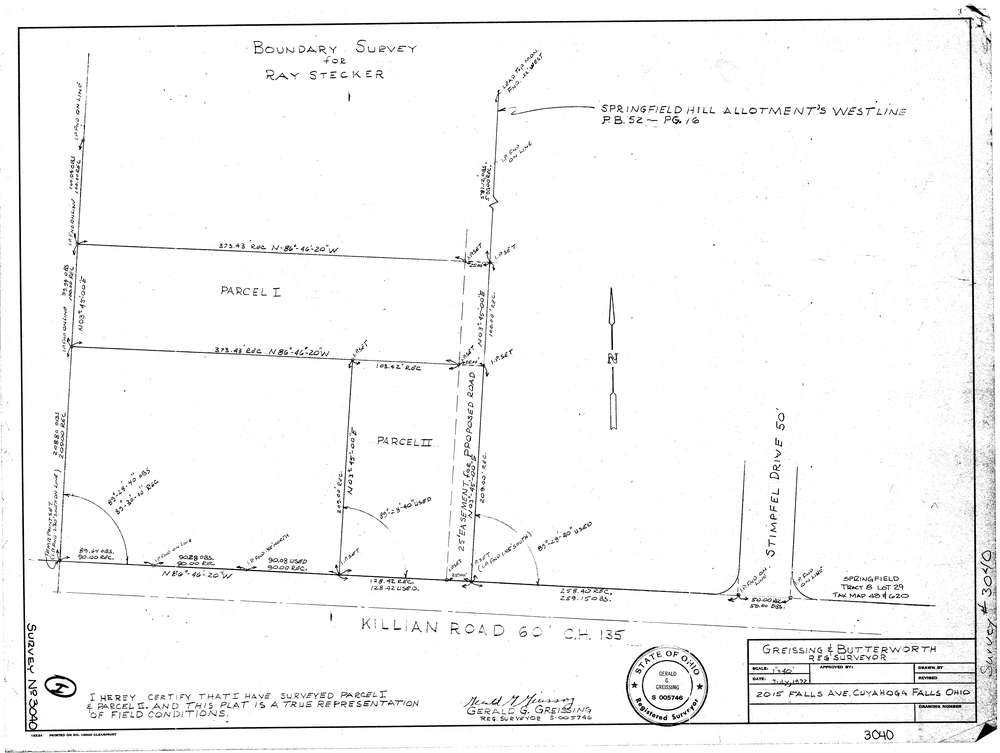
3040
Download lotsplits3040.tif
GIS Data
Latitude:
40.9965729999999
Longitude:
-81.416084
Identification
Survey identifier:
3040
Context
Original township:
Springfield
Community list:
Springfield
Surveyed on:
07/01/1972
Description
Owner:
Stecker
Description:
Primary road:
Killian Rd
Secondary road:
Near intersection:
Stimpfel Dr
Acreage:
Survey Locators
Tract list:
8
Lot list:
29
Section list:
Quarter:
Surveyor
Surveyor number:
5746
Surveyor name:
Greissing, Gerald G.
Company:
Greissing & Butterworth
Document Data
Scan File Name:
lotsplits3040.tif
Scan Pages:
1
Drawer location: