Toggle navigation
Survey Documents
Advanced Search
Supporting Data
Companies
Surveyors
Communities
Original Townships
APIs
Survey Documents API
Tutorial
About
Contact
Search
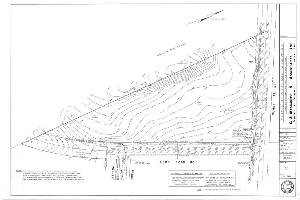
Mess-D686
Download D-686.tif
GIS Data
Latitude:
41.1411799999998
Longitude:
-81.33534
Identification
Survey identifier:
Mess-D686
Context
Original township:
Portage County
Community list:
Kent
Surveyed on:
06/07/1983
Description
Owner:
Description:
Whitehall Subdivision Block A
Primary road:
Summit St
Secondary road:
Loop Rd
Near intersection:
Athena Dr
Acreage:
Survey Locators
Tract list:
Lot list:
Section list:
Quarter:
Surveyor
Surveyor number:
4512
Surveyor name:
Messmore, Charles J.
Company:
C.J. Messmore & Associates
Document Data
Scan File Name:
D-686.tif
Scan Pages:
1
Drawer location:
265