Toggle navigation
Survey Documents
Advanced Search
Supporting Data
Companies
Surveyors
Communities
Original Townships
APIs
Survey Documents API
Tutorial
About
Contact
Search
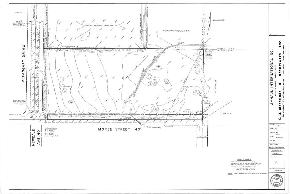
Mess-D689
Download D-689.tif
GIS Data
Latitude:
41.0600399999999
Longitude:
-81.57682
Identification
Survey identifier:
Mess-D689
Context
Original township:
Coventry
Community list:
Akron
Surveyed on:
08/30/1983
Description
Owner:
U-Haul International
Description:
Primary road:
Morse St
Secondary road:
McTaggart Dr
Near intersection:
Newdale Ave
Acreage:
Survey Locators
Tract list:
Lot list:
Section list:
Quarter:
Surveyor
Surveyor number:
4512
Surveyor name:
Messmore, Charles J.
Company:
C.J. Messmore & Associates
Document Data
Scan File Name:
D-689.tif
Scan Pages:
1
Drawer location:
265