Toggle navigation
Survey Documents
Advanced Search
Supporting Data
Companies
Surveyors
Communities
Original Townships
APIs
Survey Documents API
Tutorial
About
Contact
Search
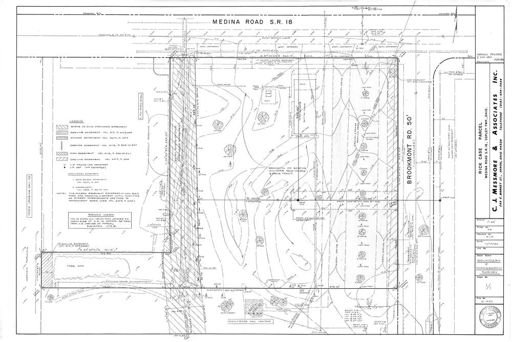
Mess-D697
Download D-697.tif
GIS Data
Latitude:
41.1355399999999
Longitude:
-81.63965
Identification
Survey identifier:
Mess-D697
Context
Original township:
Copley
Community list:
Copley
Surveyed on:
11/10/1983
Description
Owner:
Rick Case
Description:
Primary road:
Akron Medina Rd
Secondary road:
Near intersection:
Brookmont Rd
Acreage:
Survey Locators
Tract list:
Lot list:
Section list:
Quarter:
Surveyor
Surveyor number:
4512
Surveyor name:
Messmore, Charles J.
Company:
C.J. Messmore & Associates
Document Data
Scan File Name:
D-697.tif
Scan Pages:
1
Drawer location:
265