Toggle navigation
Survey Documents
Advanced Search
Supporting Data
Companies
Surveyors
Communities
Original Townships
APIs
Survey Documents API
Tutorial
About
Contact
Search
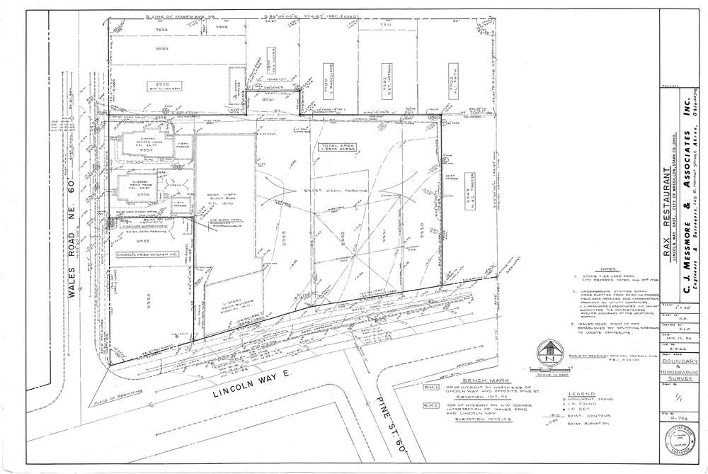
Mess-D704
Download D-704.tif
GIS Data
Latitude:
40.8003399999998
Longitude:
-81.50951
Identification
Survey identifier:
Mess-D704
Context
Original township:
Stark County
Community list:
Massillon
Surveyed on:
01/13/1984
Description
Owner:
Rax Restaurant
Description:
Primary road:
Lincoln Way E.
Secondary road:
Wales Rd
Near intersection:
Pine St
Acreage:
1.3829
Survey Locators
Tract list:
Lot list:
Section list:
Quarter:
Surveyor
Surveyor number:
4512
Surveyor name:
Messmore, Charles J.
Company:
C.J. Messmore & Associates
Document Data
Scan File Name:
D-704.tif
Scan Pages:
1
Drawer location:
265