Toggle navigation
Survey Documents
Advanced Search
Supporting Data
Companies
Surveyors
Communities
Original Townships
APIs
Survey Documents API
Tutorial
About
Contact
Search
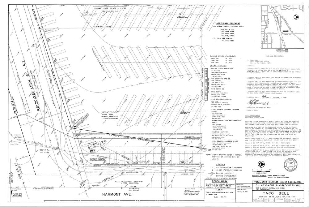
Mess-D737
Download D-737.tif
GIS Data
Latitude:
40.8376499999998
Longitude:
-81.32765
Identification
Survey identifier:
Mess-D737
Context
Original township:
Plain,Stark County
Community list:
Surveyed on:
10/15/1984
Description
Owner:
Taco Bell
Description:
Primary road:
Harmont Ave
Secondary road:
Lesh St
Near intersection:
Acreage:
0.4925
Survey Locators
Tract list:
Lot list:
Section list:
26
Quarter:
Surveyor
Surveyor number:
4512
Surveyor name:
Messmore, Charles J.
Company:
C.J. Messmore & Associates
Document Data
Scan File Name:
D-737.tif
Scan Pages:
1
Drawer location:
265