Toggle navigation
Survey Documents
Advanced Search
Supporting Data
Companies
Surveyors
Communities
Original Townships
APIs
Survey Documents API
Tutorial
About
Contact
Search
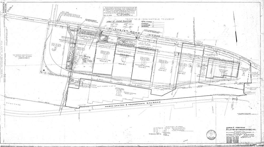
Mess-D889
Download D-889.tif
GIS Data
Latitude:
41.0565199999999
Longitude:
-81.411
Identification
Survey identifier:
Mess-D889
Context
Original township:
Springfield
Community list:
Mogadore
Surveyed on:
06/07/1972
Description
Owner:
Gilchrist-Mogadore Inc.
Description:
Summit Warehouse
Primary road:
Gilchrist Rd
Secondary road:
Near intersection:
S. Munroe Falls Rd
Acreage:
Survey Locators
Tract list:
8
Lot list:
13,14,17,18
Section list:
Quarter:
Surveyor
Surveyor number:
67
Surveyor name:
Kingsley, Dumont T.
Company:
Gehres & Kingsley, Surveyors
Document Data
Scan File Name:
D-889.tif
Scan Pages:
1
Drawer location:
265