Toggle navigation
Survey Documents
Advanced Search
Supporting Data
Companies
Surveyors
Communities
Original Townships
APIs
Survey Documents API
Tutorial
About
Contact
Search
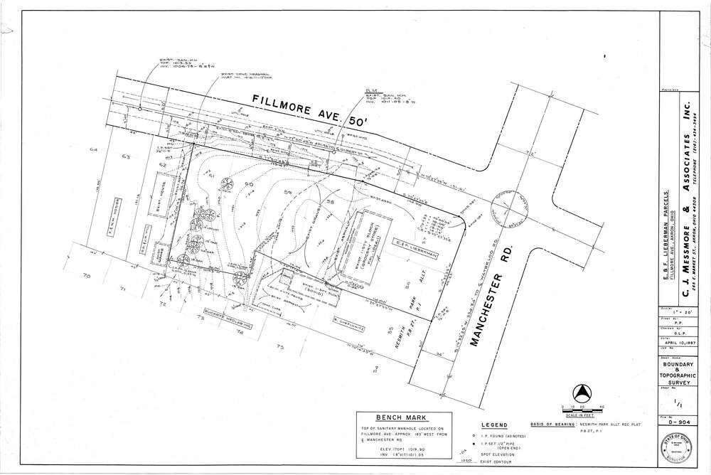
Mess-D904
Download D-904.tif
GIS Data
Latitude:
41.0313899999999
Longitude:
-81.54673
Identification
Survey identifier:
Mess-D904
Context
Original township:
Coventry
Community list:
Akron
Surveyed on:
04/10/1987
Description
Owner:
Lieberman
Description:
Nesmith Park Allt. PB27 PG1
Primary road:
Fillmore Ave
Secondary road:
Manchester Rd
Near intersection:
Acreage:
Survey Locators
Tract list:
Lot list:
Section list:
Quarter:
Surveyor
Surveyor number:
4512
Surveyor name:
Messmore, Charles J.
Company:
C.J. Messmore & Associates
Document Data
Scan File Name:
D-904.tif
Scan Pages:
1
Drawer location:
265