Toggle navigation
Survey Documents
Advanced Search
Supporting Data
Companies
Surveyors
Communities
Original Townships
APIs
Survey Documents API
Tutorial
About
Contact
Search
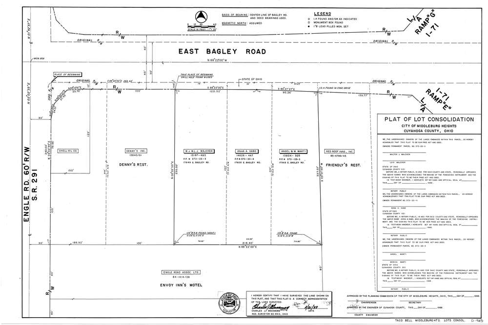
Mess-D945
Download D-945.tif
GIS Data
Latitude:
41.3715099999999
Longitude:
-81.82253
Identification
Survey identifier:
Mess-D945
Context
Original township:
Cuyahoga County
Community list:
Middleburg Heights
Surveyed on:
03/31/1988
Description
Owner:
Taco Bell
Description:
Lot Consolidation
Primary road:
Bagley Rd
Secondary road:
I-71
Near intersection:
Engle Rd
Acreage:
Survey Locators
Tract list:
Lot list:
Section list:
Quarter:
Surveyor
Surveyor number:
4512
Surveyor name:
Messmore, Charles J.
Company:
C.J. Messmore & Associates
Document Data
Scan File Name:
D-945.tif
Scan Pages:
1
Drawer location:
265