Toggle navigation
Survey Documents
Advanced Search
Supporting Data
Companies
Surveyors
Communities
Original Townships
APIs
Survey Documents API
Tutorial
About
Contact
Search
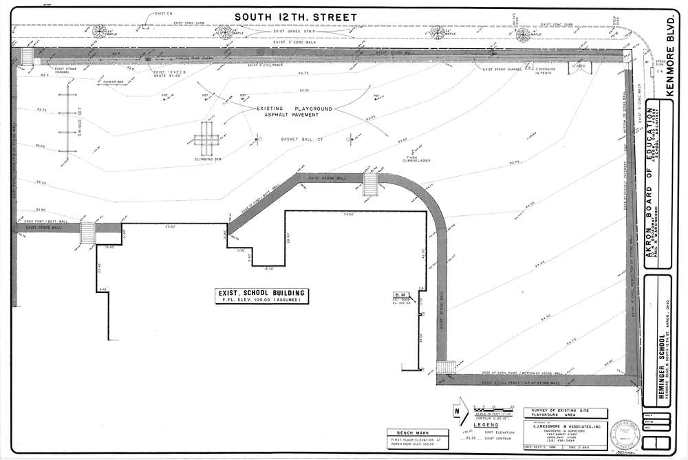
Mess-D984
Download D-984.tif
GIS Data
Latitude:
41.0434699999999
Longitude:
-81.5559
Identification
Survey identifier:
Mess-D984
Context
Original township:
Coventry
Community list:
Akron
Surveyed on:
09/05/1988
Description
Owner:
Akron Board of Education
Description:
Existing Playground Area
Primary road:
Kenmore Blvd
Secondary road:
Near intersection:
S. 12th St
Acreage:
Survey Locators
Tract list:
Lot list:
Section list:
Quarter:
Surveyor
Surveyor number:
4512
Surveyor name:
Messmore, Charles J.
Company:
C.J. Messmore & Associates
Document Data
Scan File Name:
D-984.tif
Scan Pages:
1
Drawer location:
265