Toggle navigation
Survey Documents
Advanced Search
Supporting Data
Companies
Surveyors
Communities
Original Townships
APIs
Survey Documents API
Tutorial
About
Contact
Search
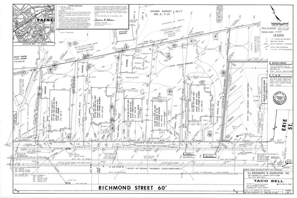
Mess-D989
Download D-989.tif
GIS Data
Latitude:
41.7253299999999
Longitude:
-81.24738
Identification
Survey identifier:
Mess-D989
Context
Original township:
Lake County
Community list:
Painesville
Surveyed on:
11/09/1988
Description
Owner:
Taco Bell
Description:
Primary road:
Richmond St
Secondary road:
Near intersection:
Erie St
Acreage:
0.584
Survey Locators
Tract list:
Lot list:
Section list:
Quarter:
Surveyor
Surveyor number:
7176
Surveyor name:
Allison, Terence R.
Company:
C.J. Messmore & Associates
Document Data
Scan File Name:
D-989.tif
Scan Pages:
1
Drawer location:
265