Toggle navigation
Survey Documents
Advanced Search
Supporting Data
Companies
Surveyors
Communities
Original Townships
APIs
Survey Documents API
Tutorial
About
Contact
Search
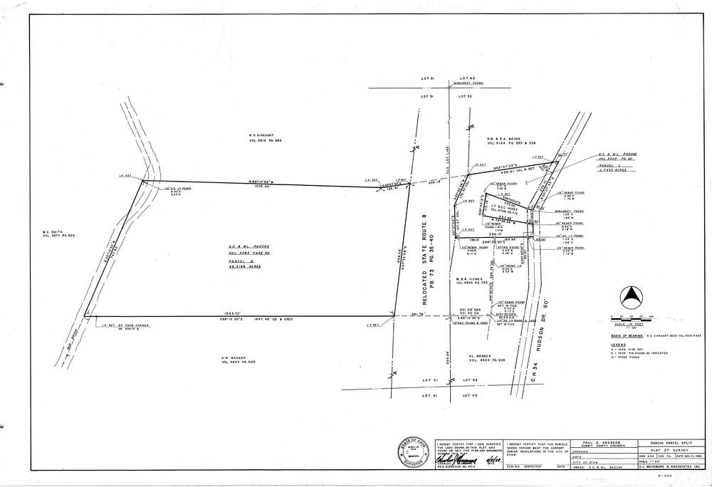
Mess-D996
Download D-996.tif
GIS Data
Latitude:
41.1760799999998
Longitude:
-81.47717
Identification
Survey identifier:
Mess-D996
Context
Original township:
Stow
Community list:
Stow
Surveyed on:
11/21/1988
Description
Owner:
Rasche
Description:
Primary road:
Hudson Dr
Secondary road:
Near intersection:
Acreage:
Survey Locators
Tract list:
Lot list:
51,52
Section list:
Quarter:
Surveyor
Surveyor number:
4512
Surveyor name:
Messmore, Charles J.
Company:
C.J. Messmore & Associates
Document Data
Scan File Name:
D-996.tif
Scan Pages:
1
Drawer location:
265