Toggle navigation
Survey Documents
Advanced Search
Supporting Data
Companies
Surveyors
Communities
Original Townships
APIs
Survey Documents API
Tutorial
About
Contact
Search
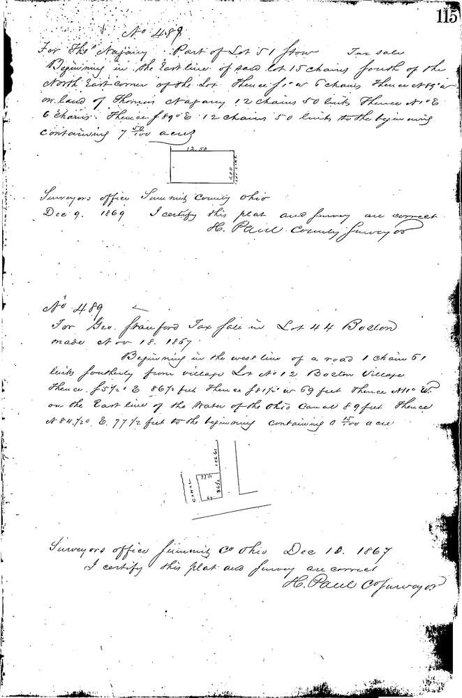
0489
Download 115.TIF
GIS Data
Latitude:
41.2636499999998
Longitude:
-81.55816
Identification
Survey identifier:
0489
Context
Original township:
Boston
Community list:
Boston
Surveyed on:
11/18/1867
Description
Owner:
Stanford
Description:
Primary road:
Secondary road:
Near intersection:
Acreage:
0.15
Survey Locators
Tract list:
Lot list:
44
Section list:
Quarter:
Surveyor
Surveyor number:
Surveyor name:
Company:
Summit County Surveyor
Document Data
Scan File Name:
115.TIF
Scan Pages:
1
Drawer location:
Survey Book 2 Pg 115