Toggle navigation
Survey Documents
Advanced Search
Supporting Data
Companies
Surveyors
Communities
Original Townships
APIs
Survey Documents API
Tutorial
About
Contact
Search
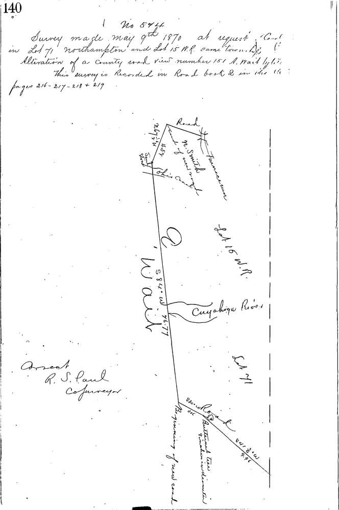
0524
Download 140.TIF
GIS Data
Latitude:
41.1992399999999
Longitude:
-81.56957
Identification
Survey identifier:
0524
Context
Original township:
Northampton
Community list:
Northampton
Surveyed on:
05/09/1870
Description
Owner:
Description:
Road Record Book 2 PG 216 Bolanz Rd
Primary road:
Secondary road:
Near intersection:
Acreage:
Survey Locators
Tract list:
Lot list:
15, 71
Section list:
Quarter:
Surveyor
Surveyor number:
Surveyor name:
Company:
Summit County Surveyor
Document Data
Scan File Name:
140.TIF
Scan Pages:
1
Drawer location:
Survey Book 2 Pg 140