Toggle navigation
Survey Documents
Advanced Search
Supporting Data
Companies
Surveyors
Communities
Original Townships
APIs
Survey Documents API
Tutorial
About
Contact
Search
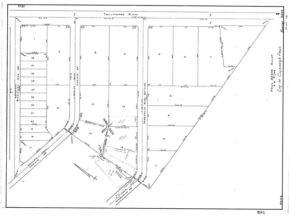
3522
Download lotsplits3522.tif
GIS Data
Latitude:
41.1219539999999
Longitude:
-81.47086
Identification
Survey identifier:
3522
Context
Original township:
Cuyahoga Falls
Community list:
Cuyahoga Falls
Surveyed on:
Description
Owner:
Description:
Falls Acres Allotment P.B.37 Pg. 48
Primary road:
Magnolia Ave
Secondary road:
Loomis Ave
Near intersection:
Tallmadge Rd
Acreage:
Survey Locators
Tract list:
Lot list:
Section list:
Quarter:
Surveyor
Surveyor number:
Surveyor name:
Company:
Document Data
Scan File Name:
lotsplits3522.tif
Scan Pages:
1
Drawer location: