Toggle navigation
Survey Documents
Advanced Search
Supporting Data
Companies
Surveyors
Communities
Original Townships
APIs
Survey Documents API
Tutorial
About
Contact
Search
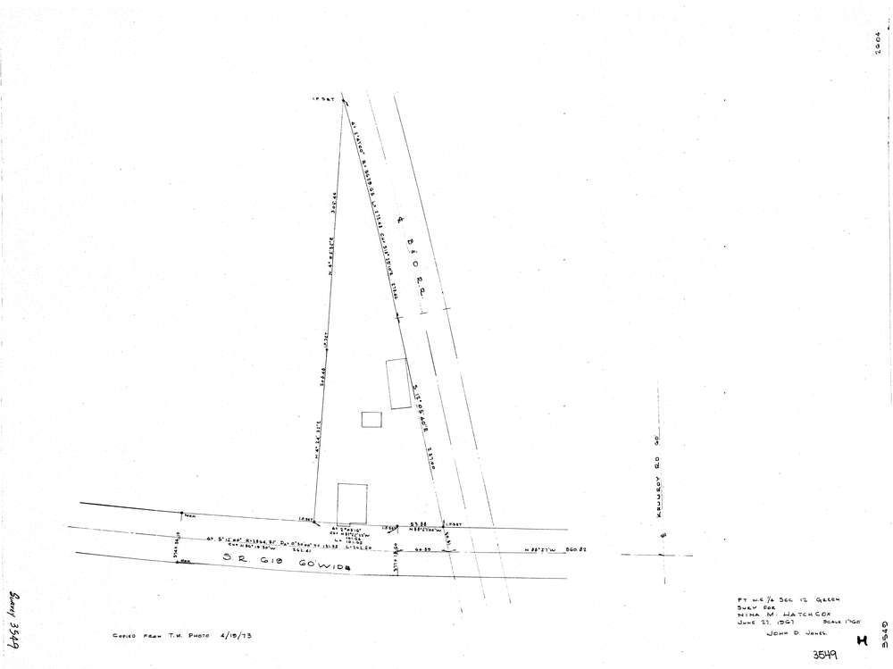
3549
Download lotsplits3549.tif
GIS Data
Latitude:
40.9764559999998
Longitude:
-81.426941
Identification
Survey identifier:
3549
Context
Original township:
Green
Community list:
Green
Surveyed on:
06/27/1967
Description
Owner:
Hatchcox
Description:
Primary road:
S.R. 619
Secondary road:
Near intersection:
Myersville Rd
Acreage:
Survey Locators
Tract list:
Lot list:
Section list:
12
Quarter:
NE
Surveyor
Surveyor number:
4362
Surveyor name:
Jones, John D.
Company:
Document Data
Scan File Name:
lotsplits3549.tif
Scan Pages:
1
Drawer location: