Toggle navigation
Survey Documents
Advanced Search
Supporting Data
Companies
Surveyors
Communities
Original Townships
APIs
Survey Documents API
Tutorial
About
Contact
Search
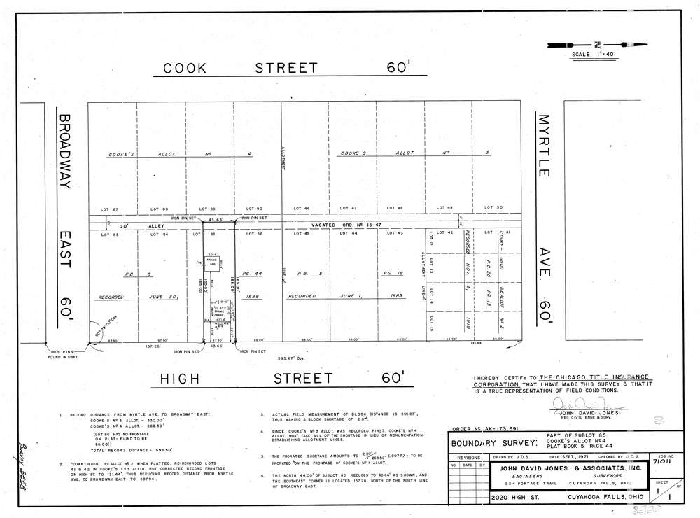
3558
Download lotsplits3558.tif
GIS Data
Latitude:
41.1338009999998
Longitude:
-81.473386
Identification
Survey identifier:
3558
Context
Original township:
Cuyahoga Falls
Community list:
Cuyahoga Falls
Surveyed on:
09/01/1971
Description
Owner:
Description:
Cooke'S Allotment No.4 S/L 85 P.B. 5 Pg. 44
Primary road:
High St
Secondary road:
Near intersection:
Myrtle Ave
Acreage:
Survey Locators
Tract list:
Lot list:
Section list:
Quarter:
Surveyor
Surveyor number:
Surveyor name:
Company:
The John David Jones Corporation
Document Data
Scan File Name:
lotsplits3558.tif
Scan Pages:
1
Drawer location: