Toggle navigation
Survey Documents
Advanced Search
Supporting Data
Companies
Surveyors
Communities
Original Townships
APIs
Survey Documents API
Tutorial
About
Contact
Search
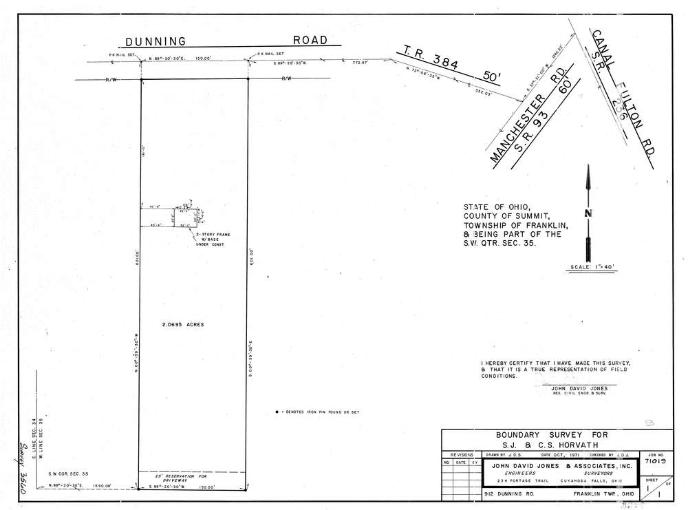
3560
Download lotsplits3560.tif
GIS Data
Latitude:
40.9127909999998
Longitude:
-81.569216
Identification
Survey identifier:
3560
Context
Original township:
Franklin
Community list:
Franklin
Surveyed on:
10/01/1971
Description
Owner:
Horvath
Description:
Primary road:
Dunning Rd
Secondary road:
Near intersection:
Manchester Rd
Acreage:
2.0695
Survey Locators
Tract list:
Lot list:
Section list:
35
Quarter:
SW
Surveyor
Surveyor number:
Surveyor name:
Company:
The John David Jones Corporation
Document Data
Scan File Name:
lotsplits3560.tif
Scan Pages:
1
Drawer location: