Toggle navigation
Survey Documents
Advanced Search
Supporting Data
Companies
Surveyors
Communities
Original Townships
APIs
Survey Documents API
Tutorial
About
Contact
Search
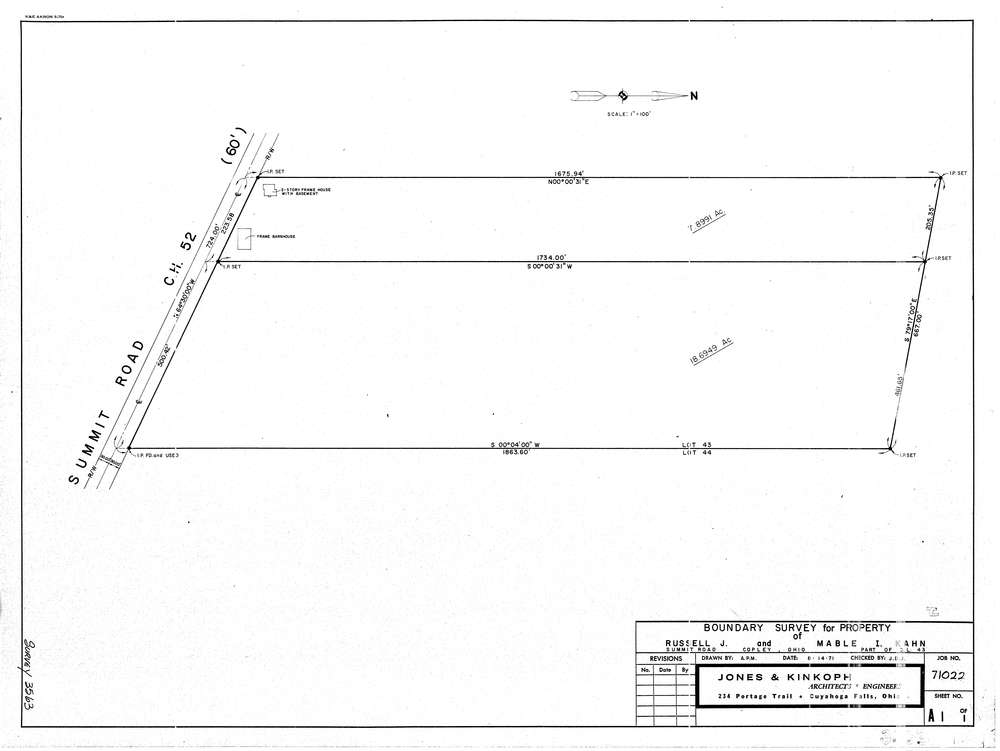
3563
Download lotsplits3563.tif
GIS Data
Latitude:
41.0714249999998
Longitude:
-81.629491
Identification
Survey identifier:
3563
Context
Original township:
Copley
Community list:
Copley
Surveyed on:
08/14/1971
Description
Owner:
Kahn
Description:
Primary road:
Summit Rd
Secondary road:
Near intersection:
Acreage:
26.0
Survey Locators
Tract list:
Lot list:
43
Section list:
Quarter:
Surveyor
Surveyor number:
Surveyor name:
Company:
Jones & Kinkoph
Document Data
Scan File Name:
lotsplits3563.tif
Scan Pages:
1
Drawer location: