Toggle navigation
Survey Documents
Advanced Search
Supporting Data
Companies
Surveyors
Communities
Original Townships
APIs
Survey Documents API
Tutorial
About
Contact
Search
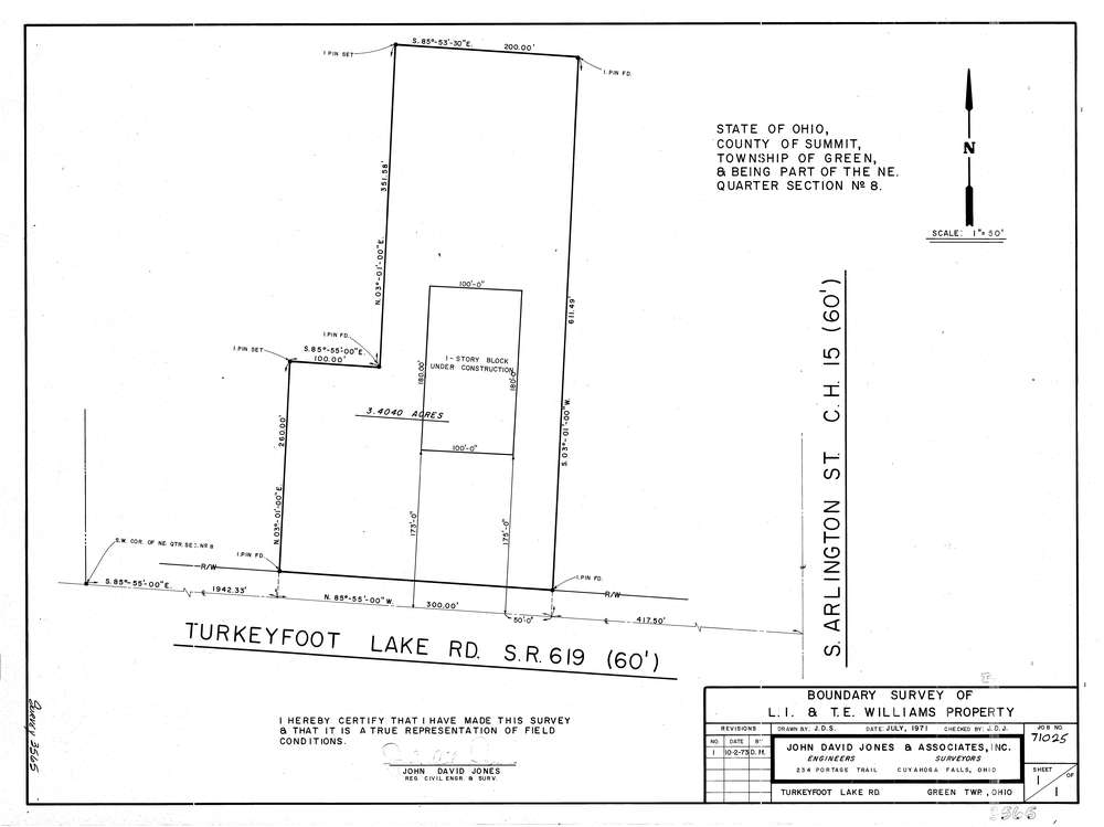
3565
Download lotsplits3565.tif
GIS Data
Latitude:
40.9754269999999
Longitude:
-81.495456
Identification
Survey identifier:
3565
Context
Original township:
Green
Community list:
Green
Surveyed on:
07/01/1971
Description
Owner:
Williams
Description:
Primary road:
Turkeyfoot Lake Rd
Secondary road:
Near intersection:
South Arlington St
Acreage:
3.404
Survey Locators
Tract list:
Lot list:
Section list:
8
Quarter:
NE
Surveyor
Surveyor number:
Surveyor name:
Company:
The John David Jones Corporation
Document Data
Scan File Name:
lotsplits3565.tif
Scan Pages:
1
Drawer location: