Toggle navigation
Survey Documents
Advanced Search
Supporting Data
Companies
Surveyors
Communities
Original Townships
APIs
Survey Documents API
Tutorial
About
Contact
Search
3567
Download lotsplits3567.tif
GIS Data
Latitude:
41.0573249999999
Longitude:
-81.471573
Identification
Survey identifier:
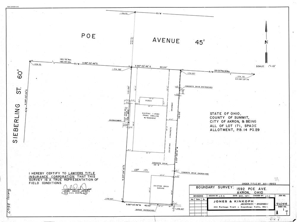
3567
Context
Original township:
Akron
Community list:
Akron
Surveyed on:
05/01/1971
Description
Owner:
Description:
S/L 171 Spade Allotment P.B. 14 Pg. 29
Primary road:
Poe Ave
Secondary road:
Near intersection:
Seiberling St
Acreage:
Survey Locators
Tract list:
Lot list:
Section list:
Quarter:
Surveyor
Surveyor number:
Surveyor name:
Company:
Jones & Kinkoph
Document Data
Scan File Name:
lotsplits3567.tif
Scan Pages:
1
Drawer location: