Toggle navigation
Survey Documents
Advanced Search
Supporting Data
Companies
Surveyors
Communities
Original Townships
APIs
Survey Documents API
Tutorial
About
Contact
Search
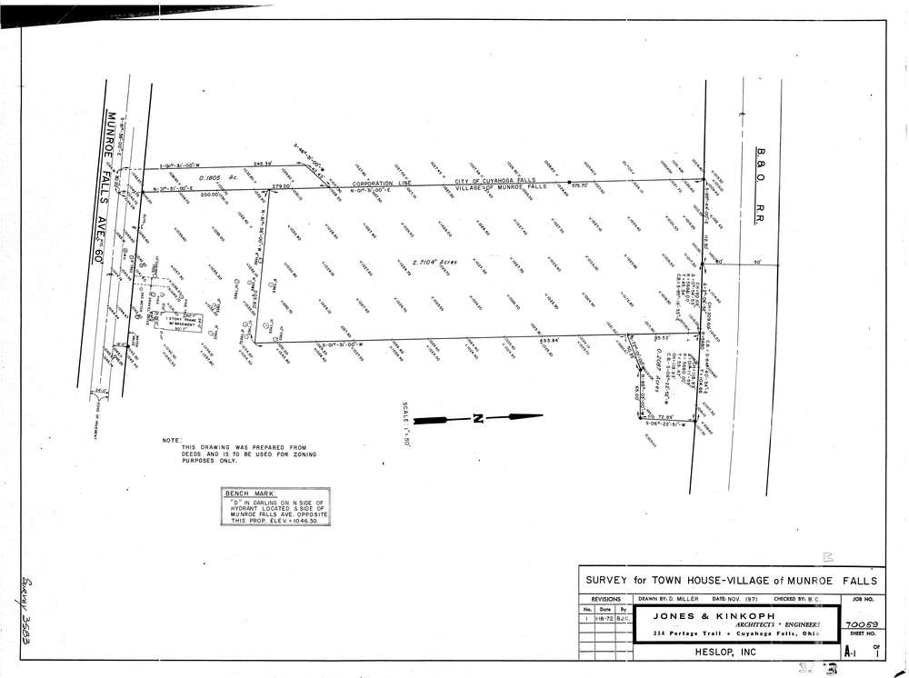
3583
Download lotsplits3583.tif
GIS Data
Latitude:
41.1415019999998
Longitude:
-81.449574
Identification
Survey identifier:
3583
Context
Original township:
Munroe Falls
Community list:
Munroe Falls
Surveyed on:
01/18/1972
Description
Owner:
Description:
Primary road:
Munroe Falls Ave
Secondary road:
Near intersection:
Acreage:
2.7104
Survey Locators
Tract list:
Lot list:
Section list:
Quarter:
Surveyor
Surveyor number:
Surveyor name:
Company:
Jones & Kinkoph
Document Data
Scan File Name:
lotsplits3583.tif
Scan Pages:
1
Drawer location: