Toggle navigation
Survey Documents
Advanced Search
Supporting Data
Companies
Surveyors
Communities
Original Townships
APIs
Survey Documents API
Tutorial
About
Contact
Search
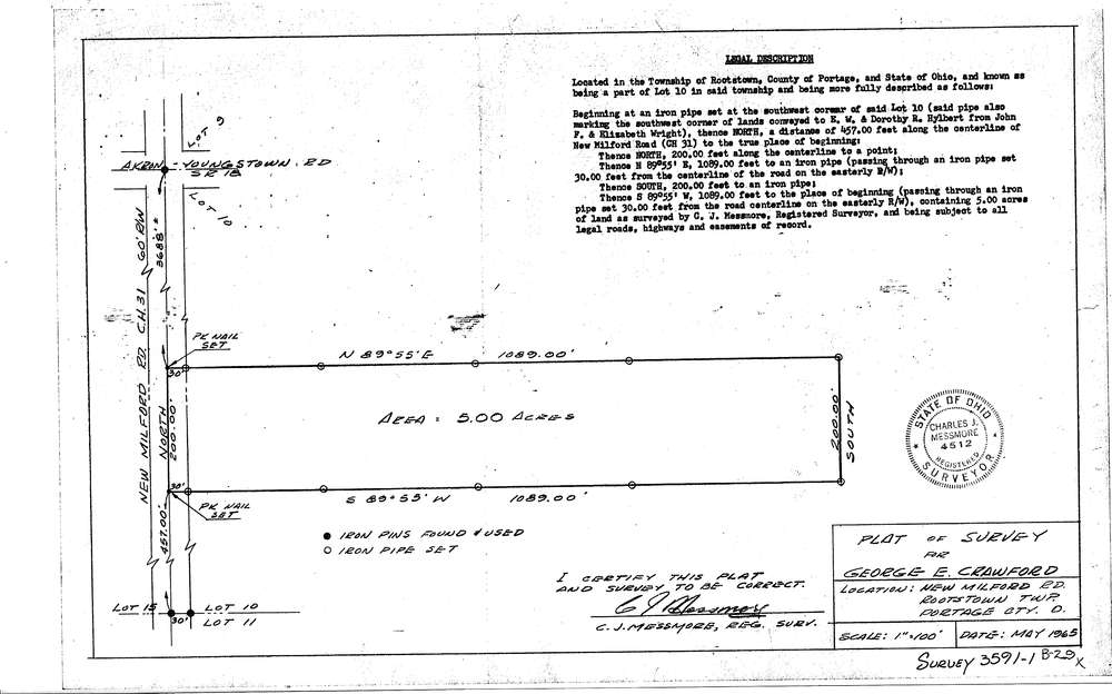
3591-1
Download SURVEY-3591-1_0001.tif
GIS Data
Latitude:
41.0885999999999
Longitude:
-81.22078
Identification
Survey identifier:
3591-1
Context
Original township:
Rootstown
Community list:
Surveyed on:
05/17/1965
Description
Owner:
George E. Crawford
Description:
Primary road:
New Milford Road C.H.31
Secondary road:
Near intersection:
S.R.18
Acreage:
5.0
Survey Locators
Tract list:
Lot list:
10
Section list:
Quarter:
Surveyor
Surveyor number:
4512
Surveyor name:
Messmore, Charles J.
Company:
Document Data
Scan File Name:
SURVEY-3591-1_0001.tif
Scan Pages:
1
Drawer location:
016