Toggle navigation
Survey Documents
Advanced Search
Supporting Data
Companies
Surveyors
Communities
Original Townships
APIs
Survey Documents API
Tutorial
About
Contact
Search
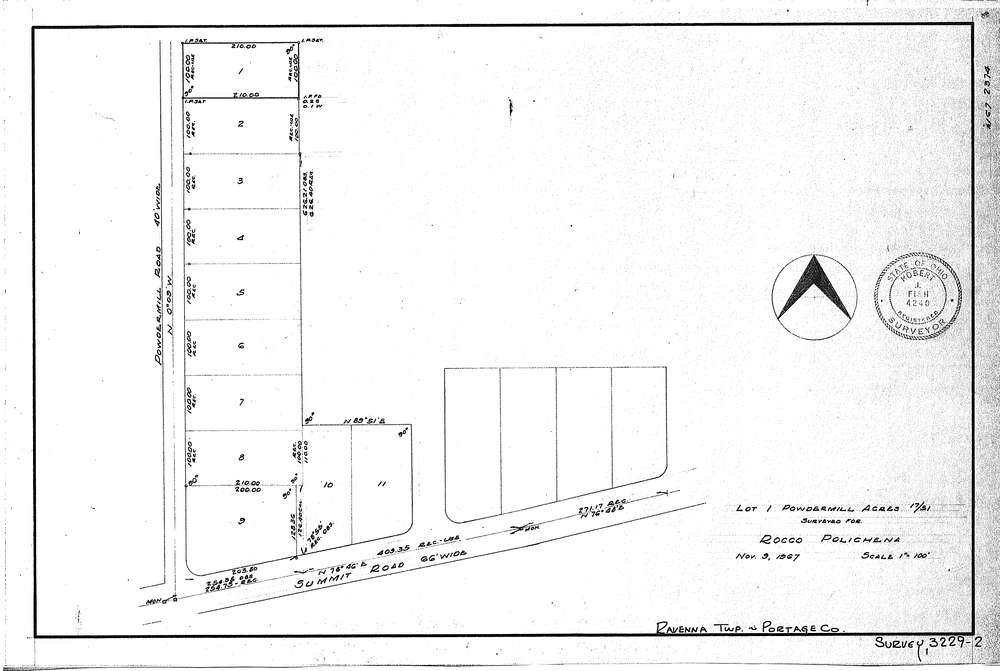
3229-2
Download SURVEY-3229-2_0001.tif
GIS Data
Latitude:
41.1398599999999
Longitude:
-81.30507
Identification
Survey identifier:
3229-2
Context
Original township:
Ravenna
Community list:
Surveyed on:
11/09/1967
Description
Owner:
Rocco Polichena
Description:
Lot 1 of Powder Mill Acres
Primary road:
Powder Mill Road
Secondary road:
Near intersection:
Summit Road
Acreage:
Survey Locators
Tract list:
Lot list:
Section list:
Quarter:
Surveyor
Surveyor number:
4240
Surveyor name:
Fish, Robert J.
Company:
Document Data
Scan File Name:
SURVEY-3229-2_0001.tif
Scan Pages:
1
Drawer location:
016