Toggle navigation
Survey Documents
Advanced Search
Supporting Data
Companies
Surveyors
Communities
Original Townships
APIs
Survey Documents API
Tutorial
About
Contact
Search
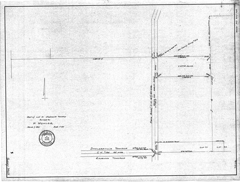
3463
Download SURVEY-3463_0001.tif
GIS Data
Latitude:
41.2040419999999
Longitude:
-81.213946
Identification
Survey identifier:
3463
Context
Original township:
Shalersville
Community list:
Surveyed on:
03/07/1961
Description
Owner:
W. Mohler
Description:
Primary road:
Peck Road (C.H.#167)
Secondary road:
Near intersection:
Lake Rockwell Road (C.H.#154)
Acreage:
2.5775
Survey Locators
Tract list:
Lot list:
21
Section list:
Quarter:
Surveyor
Surveyor number:
4240
Surveyor name:
Fish, Robert J.
Company:
Document Data
Scan File Name:
SURVEY-3463_0001.tif
Scan Pages:
1
Drawer location:
016