Toggle navigation
Survey Documents
Advanced Search
Supporting Data
Companies
Surveyors
Communities
Original Townships
APIs
Survey Documents API
Tutorial
About
Contact
Search
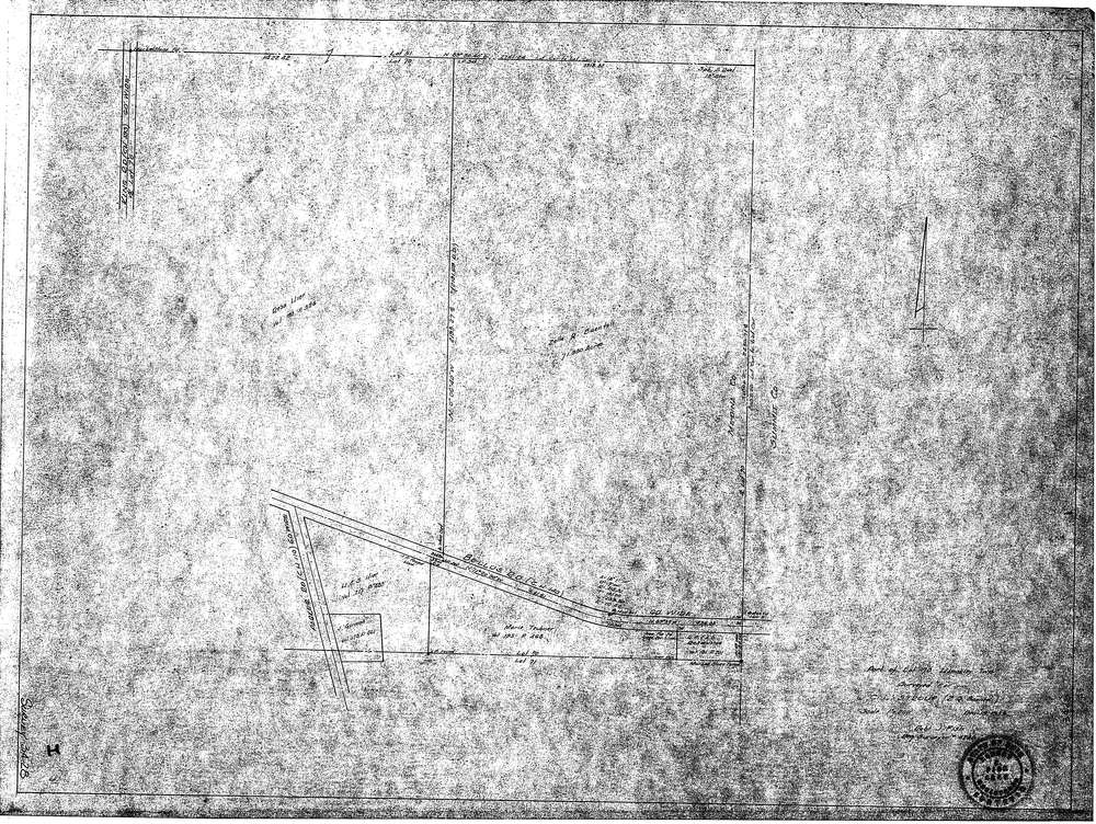
3428
Download SURVEY-3428_0001.tif
GIS Data
Latitude:
41.2255499999998
Longitude:
-81.68724
Identification
Survey identifier:
3428
Context
Original township:
Hinckley
Community list:
Surveyed on:
12/19/1955
Description
Owner:
C.L.Stroup(Z.Q.Beanteli)
Description:
Primary road:
Bellus Road(C.H.140)
Secondary road:
Near intersection:
Parker Road(C.H.110)
Acreage:
71.95
Survey Locators
Tract list:
Lot list:
70
Section list:
Quarter:
Surveyor
Surveyor number:
4240
Surveyor name:
Fish, Robert J.
Company:
Document Data
Scan File Name:
SURVEY-3428_0001.tif
Scan Pages:
1
Drawer location:
016